Thursday, 23 May 2013

Friday, 3 May 2013
INFOMAR SEAI SURVEY 2013
From mid-March through to the end of April, the R.V. Celtic Voyager was tasked with the mapping of the seabed off the West Clare coast.
Due to the ideal wave regime, favourable seabed morphology and proximal port facilities, this area has been identified as a suitable region for the future deployment of wave energy converters. Sustainable Energy Authority Ireland (SEAI) leads a project to help realise this potential.
The INFOMAR program is collaborating with SEAI to provide them with a detailed understanding of the seabed morphology and surficial geology over this extensive area. Considerations of these environmental factors are critical to the planning and development of such marine infrastructure.
Despite challenging conditions for the vessel’s crew and survey team due to prolonged adverse weather, good coverage was achieved close to the coast.
The image below shows the extent of the multibeam and geophysical data collected by INFOMAR in support of the SEAI initiative.

The acquired multibeam data show some spectacular structures in the siliclastic bedrock and a Namurian/ Carboniferous contact.


Due to the ideal wave regime, favourable seabed morphology and proximal port facilities, this area has been identified as a suitable region for the future deployment of wave energy converters. Sustainable Energy Authority Ireland (SEAI) leads a project to help realise this potential.
The INFOMAR program is collaborating with SEAI to provide them with a detailed understanding of the seabed morphology and surficial geology over this extensive area. Considerations of these environmental factors are critical to the planning and development of such marine infrastructure.
Despite challenging conditions for the vessel’s crew and survey team due to prolonged adverse weather, good coverage was achieved close to the coast.
The image below shows the extent of the multibeam and geophysical data collected by INFOMAR in support of the SEAI initiative.
The acquired multibeam data show some spectacular structures in the siliclastic bedrock and a Namurian/ Carboniferous contact.


Thursday, 1 November 2012
KRY12_03 / GEO12_02 - Inishbofin, Inishturk & Killary Harbour
In July and August 2012, the RV Keary and RV Geo spent several weeks mapping the seabed around Inishbofin, Inishturk and Killary Harbour. The vessels were based in Inishbofin harbour for the duration of the survey.
Initially, two specific sites were mapped for BIM (Bord Iascaigh Mhara) who are investigating the potential of deep-water aquaculture sites in the area. In addition, a larger area around the islands was mapped to provide bathymetric data for oceanographic current modelling to be carried out by the Marine Institute, along with extending INFOMAR coverage into the area around the islands.
The survey data revealed very interesting underwater topography, containing extensive rocky outcrop, fault lines and sedimentary features.
Below are images of the survey coverage and the vessels at work. Note that the colour scales may vary between the survey coverage images - the red and blue ends of the spectrum represent shallower and deeper water, respectively.
 Survey coverage by RV Keary and RV Geo around Inishbofin and Inishturk. The RV Geo carried out the shallower water mapping along the coastlines. Data in this image is still in the process of being finalised and contains some errors.
 The "Stags" rocks off the NW coast of Inishbofin.
 A view of Inishturk's rugged coastline from the RV Geo.
 RV Keary.
 A backscatter map of the seabed around Inishbofin and Inishturk, merged with a shaded relief map. Backscatter maps are produced from the strength of the sound waves returning to the multibeam sonar, having reflected off the seafloor - this provides information on seafloor hardness, which is then represented in greyscale here (darker shades represent harder seabed). The grey polygon in the centre and eastern part of the map represents the extent of seabed previously mapped by the RV Celtic Explorer.
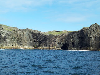 Folded rock strata on Inishturk's coastline. The onshore geology on both islands is complex and ancient - the seabed mapping carried out during the survey should help to extend the understanding of it into the offshore environment.
 RV Keary transiting from Inishbofin to Cleggan.
 RV Keary tied up alongside Inishbofin's ferry, the Island Discovery, in Inishbofin harbour.
 Structural geology of Inishturk, with seabed coverage by RV Keary and RV Geo around the island. Onshore, faults are shown in black and the synclinal axes of folded strata are shown in red. The fault marked with the red arrow appears to extend offshore in a south-easterly direction as a discontinuity in the seabed rock outcrop.
Along with successfully acquiring bathymetric data, the INFOMAR vessels completed inshore mapping around Inishbofin and Inishturk - the data will be freely available in several formats on the INFOMAR website in the future.
Initially, two specific sites were mapped for BIM (Bord Iascaigh Mhara) who are investigating the potential of deep-water aquaculture sites in the area. In addition, a larger area around the islands was mapped to provide bathymetric data for oceanographic current modelling to be carried out by the Marine Institute, along with extending INFOMAR coverage into the area around the islands.
The survey data revealed very interesting underwater topography, containing extensive rocky outcrop, fault lines and sedimentary features.
Below are images of the survey coverage and the vessels at work. Note that the colour scales may vary between the survey coverage images - the red and blue ends of the spectrum represent shallower and deeper water, respectively.


Along with successfully acquiring bathymetric data, the INFOMAR vessels completed inshore mapping around Inishbofin and Inishturk - the data will be freely available in several formats on the INFOMAR website in the future.
Wednesday, 24 October 2012
KRY12_02 Bunmahon
Between the 13th and 18th June 2012, the RV Keary carried out seabed mapping off the coast of Bunmahon, Co. Waterford. This survey was conducted in support of the INTERREG funded Atlanterra Project, which has designated the Bunmahon area as a Geo-park. Learn more about Atlanterra at http://www.gsi.ie/Programmes/Heritage+and+Planning/Heritage/Atlanterra.htm.
During the survey work the Keary was based in the port of Dunmore East, from which the vessel could transit to the survey area. Existing bathymetric data lay to the south, having been collected by the RV Celtic Voyager in 2007, and it was ensured that the RV Keary's coverage overlapped with that to provide quality control on the data.
Two uncharted shoals were mapped during the course of the survey, with this information then delivered to the UK Hydrographic Office (UKHO) in the form of H-notes. The UKHO will then issue a Notice to Mariners, alerting them to these hazards and will include the shoals in New Editions of charts.
Examples of the data collected are below:
 Seabed data collected off Bunmahon shown as shaded relief
 Backscatter image of the seabed off Bunmahon. The RV Keary uses a multibeam sonar to map the seabed - when the sound waves it produces reflect back off the seabed, the strength of the return provides information on the hardness of the seafloor material. This greyscale map was produced using that data. Note also that this image shows the data collected by the Celtic Voyager to the south.
 Shoal discovered during survey operations - originally charted at 14m depth (LAT) but now found to be at 7.5m depth (LAT). The top half of the image shows it in plan view, while the lower half is a profile view. LAT = Lowest Astronomical Tide.
During the survey work the Keary was based in the port of Dunmore East, from which the vessel could transit to the survey area. Existing bathymetric data lay to the south, having been collected by the RV Celtic Voyager in 2007, and it was ensured that the RV Keary's coverage overlapped with that to provide quality control on the data.
Two uncharted shoals were mapped during the course of the survey, with this information then delivered to the UK Hydrographic Office (UKHO) in the form of H-notes. The UKHO will then issue a Notice to Mariners, alerting them to these hazards and will include the shoals in New Editions of charts.
Examples of the data collected are below:


Tuesday, 19 June 2012
INIS-Hydro - 2012 Progress
The 2012 survey season began with the RV Keary and RV Geo vessels making a return to Dundalk Bay, to continue mapping as part of the INISHydro Project. Both vessels have been re-mobilised and kitted out with survey instrumentation after wintering in Dublin.
The Geo, a 7.5m RIB operated by the Geological Survey of Ireland, underwent some significant re-fitting - this took the form of an extension to the aft part of the cabin, allowing for a larger work area for the surveyor's station and an equipment rack for the dry end of the survey instrumentation. A generator was also fitted in the Geo's engine bay, which removed the previous reliance on batteries to power the survey gear. These additions have greatly increased the RV Geo's capabilities as a survey craft.

RV Keary arriving into Port Oriel at sunset. Both vessels operated from this harbour, which is situated south of Dundalk Bay
INIS-hydro is a 3 year INTERREG IVA Programme with the Maritime and Coastguard Agency (MCA) in the UK as lead partners. The project brings together 7 partners to conduct hydrographic surveys in Ireland, Northern Ireland and Scotland. The partners are the MCA, Geological Survey of Ireland (GSI), Marine Institute (MI), the Agri-Food and Biosciences Institute (AFBI), the Scotish Association of Marine Science (SAMS), the Northern Lighthouse Board (NLB) and the United Kingdom Hydrographic Office (UKHO).

Areas of seabed to be mapped during the INISHydro project
The surveys will be undertaken in Dundalk Bay, Carlingford Lough, Dundrum Bay, the Firth of Lorn and South West of Islay by several different vessels drawing on expertise from the various partners. The bathymetric data will deliver 3D baseline maps using multibeam echosounder technology which will be freely distributed. The project also plans to harmonise hydrographic survey specifications and synchronisation for future surveys.

INISHydro partner organisations
These surveys comply with the partners obligations under the Safety of Life at Sea conventions and will be augmented with auxiliary scientific data collected in conjunction with the bathymetric data. Details of the project can be found on the website at http://www.inis-hydro.eu/
The project is essential as the current nautical charts for these areas were produced largely in the 19th century and whilst they were an enormous achievement for the surveyors of their day, these charts are not as reliable as their terrestrial counterparts and warrant updating. The territories to be mapped in the INISHydro project encompass important navigation channels, areas of environmental interest and potential sites for marine renewable energy. INISHydro also involves a very significant level of cooperation, bringing together so many partner organisations.

RV Keary and RV Geo in Port Oriel. Note the cabin extension on the Geo, which was added prior to this survey season
INISHydro mapping in 2012 commenced in April, with the arrival of RV Keary and RV Geo in Port Oriel. The vessels worked in partnership, with the Keary focusing on the approaches to Dundalk Harbour and the Geo carrying out survey operations around Dunany Point and the southern, shallow portion of Dundalk Bay.

Strong winds resulted in a rough sea state at times
Due to the exposed nature of Dundalk Bay, operations were sometimes hampered by regular strong, easterly winds. However, in spite of this the vessels significantly extended the bathymetric coverage that was gained last year (bathymetry is the water depth). The Keary mapped out a large wedge-shaped area of seabed that includes an interesting channel-like feature - this feature was also noted in last year's INISHydro blog entry.

RV Keary 2012 bathymetric coverage (does not include RV Geo coverage)
The Geo extended last year's shallow water coverage into an area of shoals around the headland of Dunany Point at the southern extent of Dundalk Bay, along with merging with RV Keary coverage to the east.

RV Geo coverage to date, merging with Keary coverage in the east. Note that the colour scale is different from the previous image - similar colours between the images do not represent the same depth

Mini ROV (Remotely-Operated Vehicle), a valuable tool for inspecting the Keary's propellors
The Geo, a 7.5m RIB operated by the Geological Survey of Ireland, underwent some significant re-fitting - this took the form of an extension to the aft part of the cabin, allowing for a larger work area for the surveyor's station and an equipment rack for the dry end of the survey instrumentation. A generator was also fitted in the Geo's engine bay, which removed the previous reliance on batteries to power the survey gear. These additions have greatly increased the RV Geo's capabilities as a survey craft.

RV Keary arriving into Port Oriel at sunset. Both vessels operated from this harbour, which is situated south of Dundalk Bay
INIS-hydro is a 3 year INTERREG IVA Programme with the Maritime and Coastguard Agency (MCA) in the UK as lead partners. The project brings together 7 partners to conduct hydrographic surveys in Ireland, Northern Ireland and Scotland. The partners are the MCA, Geological Survey of Ireland (GSI), Marine Institute (MI), the Agri-Food and Biosciences Institute (AFBI), the Scotish Association of Marine Science (SAMS), the Northern Lighthouse Board (NLB) and the United Kingdom Hydrographic Office (UKHO).

Areas of seabed to be mapped during the INISHydro project
The surveys will be undertaken in Dundalk Bay, Carlingford Lough, Dundrum Bay, the Firth of Lorn and South West of Islay by several different vessels drawing on expertise from the various partners. The bathymetric data will deliver 3D baseline maps using multibeam echosounder technology which will be freely distributed. The project also plans to harmonise hydrographic survey specifications and synchronisation for future surveys.

INISHydro partner organisations
These surveys comply with the partners obligations under the Safety of Life at Sea conventions and will be augmented with auxiliary scientific data collected in conjunction with the bathymetric data. Details of the project can be found on the website at http://www.inis-hydro.eu/
The project is essential as the current nautical charts for these areas were produced largely in the 19th century and whilst they were an enormous achievement for the surveyors of their day, these charts are not as reliable as their terrestrial counterparts and warrant updating. The territories to be mapped in the INISHydro project encompass important navigation channels, areas of environmental interest and potential sites for marine renewable energy. INISHydro also involves a very significant level of cooperation, bringing together so many partner organisations.

RV Keary and RV Geo in Port Oriel. Note the cabin extension on the Geo, which was added prior to this survey season
INISHydro mapping in 2012 commenced in April, with the arrival of RV Keary and RV Geo in Port Oriel. The vessels worked in partnership, with the Keary focusing on the approaches to Dundalk Harbour and the Geo carrying out survey operations around Dunany Point and the southern, shallow portion of Dundalk Bay.
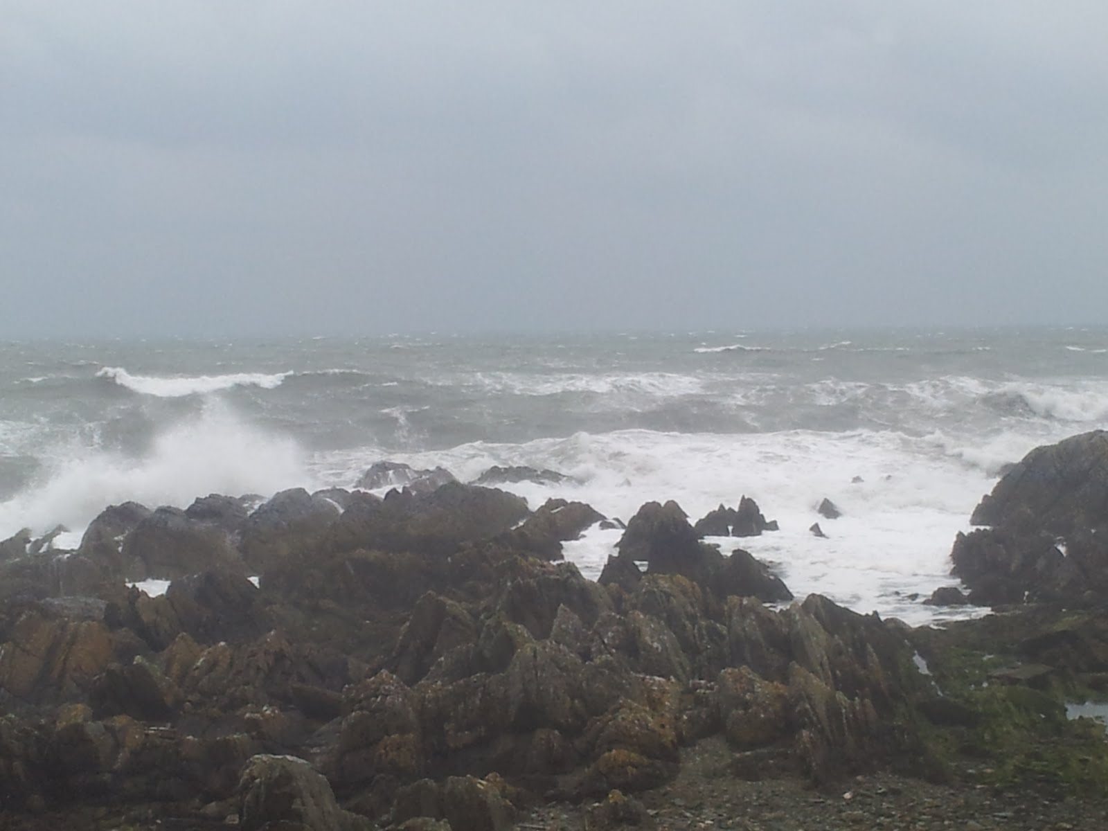
Strong winds resulted in a rough sea state at times
Due to the exposed nature of Dundalk Bay, operations were sometimes hampered by regular strong, easterly winds. However, in spite of this the vessels significantly extended the bathymetric coverage that was gained last year (bathymetry is the water depth). The Keary mapped out a large wedge-shaped area of seabed that includes an interesting channel-like feature - this feature was also noted in last year's INISHydro blog entry.

RV Keary 2012 bathymetric coverage (does not include RV Geo coverage)
The Geo extended last year's shallow water coverage into an area of shoals around the headland of Dunany Point at the southern extent of Dundalk Bay, along with merging with RV Keary coverage to the east.

RV Geo coverage to date, merging with Keary coverage in the east. Note that the colour scale is different from the previous image - similar colours between the images do not represent the same depth

Mini ROV (Remotely-Operated Vehicle), a valuable tool for inspecting the Keary's propellors
Friday, 11 November 2011
Kilmore Quay, Wexford & Rosslare Surveys
After completing the first survey leg of the 2011 season in Waterford Harbour, the Geological Survey of Ireland's (GSI) 7m RIB (Rigid Inflatable Boat), RV Geo, was taken out of the water in late June and transported by land to Wexford for the second leg - surveys of Wexford Harbour, Kilmore Quay and Rosslare. The latter was predominantly carried out by the GSI's 15m aluminium catamaran, the RV Keary, while the first two areas were mapped solely by the Geo due to their very shallow nature.
Wexford proved to be a highly challenging area to survey, with numerous shallow sand banks forcing the Geo to operate in waters as shoal as 2m. With its fragile transducer hanging 0.6m below the waterline, this required great skill on the part of the skipper to safely manoeuvre the vessel through the shallows. To further complicate matters, the sand banks of Wexford harbour are highly mobile, and so their distribution no longer matched the existing nautical charts - hence the great need for an updated survey of the area.
Along with a requirement for very careful navigation, the survey crew also had to keep a careful watch on the tidal conditions. Due to its shallow nature, safe navigation between the shoals of Wexford harbour is extremely restricted by the tide - in many areas the Geo could only operate at high tide, with some of those areas drying out at lower water levels.

RV Geo on survey operations

RV Keary navigating off the coast
Another feature to note in Wexford harbour was the presence of a large seal colony. Great care was taken not to disturb the creatures during survey operations and so the Geo's surveyor also doubled-up as a marine mammal observer (MMO). In addition to reporting on the survey, the surveyor created an MMO report detailing sightings of the seals - a useful dataset in itself for marine biologists.

Survey area mapped by the RV Geo through Waterford Harbour. The blue end of the colour scale represents deeper water, with the shallow seabed represented as green, through yellow to red.

A large number of seals were observed on the edge of the sandbank in Wexford harbour
In addition to mapping the seabed with sonar, the crew of the RV Geo also collected many sound velocity profile (SVP) data.
The SVP data is necessary because the sonar systems measure the travel time of sound waves through the water. As water temperature and salinity differ from within and between survey areas, so too does the speed of sound. Therefore these effects must be corrected for in order to accurately map the seabed. The SVP data was acquired by lowering a probe down into the water column, measuring the temperature and salinity of the water and therefore providing the survey team with a record of the sound velocity in a given location. By conducting regular sound velocity casts in Wexford harbour, the team ensured that the final dataset would require minimal processing to correct for errors created by the changes in the water column. The advantage of acquiring this data is that the information gathered during the survey constitutes a unique dataset which can have additional use in the study of the local oceanography of the area.
Following the survey of Wexford Harbour, the RV Geo was transited by sea to Rosslare harbour. The RV Keary had commenced survey operations in Rosslare at this point, and both vessels conducted survey operations in the area. The RV Keary conducted the bulk of the survey work, with the Geo briefly carrying out bathymetric mapping.

Survey coverage in Rosslare harbour
Following survey operations in Rosslare, the RV Geo was taken out of the water and transported by land to Kilmore Quay, while the RV Keary remained in Rosslare to continue operations. A similar survey strategy was employed at Kilmore Quay, involving further mapping of the seabed using sonar and SVP data acquisition. A feature of interest off the coast there is St. Patrick's bridge, a ridge of raised seabed that juts southwards. Along with shallow areas near the harbour, this feature could only be crossed by RV Geo at high tide, and so like Wexford this survey also included tidally-restricted areas.

Survey coverage by RV Geo at Kilmore Quay
Wexford proved to be a highly challenging area to survey, with numerous shallow sand banks forcing the Geo to operate in waters as shoal as 2m. With its fragile transducer hanging 0.6m below the waterline, this required great skill on the part of the skipper to safely manoeuvre the vessel through the shallows. To further complicate matters, the sand banks of Wexford harbour are highly mobile, and so their distribution no longer matched the existing nautical charts - hence the great need for an updated survey of the area.
Along with a requirement for very careful navigation, the survey crew also had to keep a careful watch on the tidal conditions. Due to its shallow nature, safe navigation between the shoals of Wexford harbour is extremely restricted by the tide - in many areas the Geo could only operate at high tide, with some of those areas drying out at lower water levels.

RV Geo on survey operations

RV Keary navigating off the coast
Another feature to note in Wexford harbour was the presence of a large seal colony. Great care was taken not to disturb the creatures during survey operations and so the Geo's surveyor also doubled-up as a marine mammal observer (MMO). In addition to reporting on the survey, the surveyor created an MMO report detailing sightings of the seals - a useful dataset in itself for marine biologists.

Survey area mapped by the RV Geo through Waterford Harbour. The blue end of the colour scale represents deeper water, with the shallow seabed represented as green, through yellow to red.

A large number of seals were observed on the edge of the sandbank in Wexford harbour
In addition to mapping the seabed with sonar, the crew of the RV Geo also collected many sound velocity profile (SVP) data.
The SVP data is necessary because the sonar systems measure the travel time of sound waves through the water. As water temperature and salinity differ from within and between survey areas, so too does the speed of sound. Therefore these effects must be corrected for in order to accurately map the seabed. The SVP data was acquired by lowering a probe down into the water column, measuring the temperature and salinity of the water and therefore providing the survey team with a record of the sound velocity in a given location. By conducting regular sound velocity casts in Wexford harbour, the team ensured that the final dataset would require minimal processing to correct for errors created by the changes in the water column. The advantage of acquiring this data is that the information gathered during the survey constitutes a unique dataset which can have additional use in the study of the local oceanography of the area.
Following the survey of Wexford Harbour, the RV Geo was transited by sea to Rosslare harbour. The RV Keary had commenced survey operations in Rosslare at this point, and both vessels conducted survey operations in the area. The RV Keary conducted the bulk of the survey work, with the Geo briefly carrying out bathymetric mapping.

Survey coverage in Rosslare harbour
Following survey operations in Rosslare, the RV Geo was taken out of the water and transported by land to Kilmore Quay, while the RV Keary remained in Rosslare to continue operations. A similar survey strategy was employed at Kilmore Quay, involving further mapping of the seabed using sonar and SVP data acquisition. A feature of interest off the coast there is St. Patrick's bridge, a ridge of raised seabed that juts southwards. Along with shallow areas near the harbour, this feature could only be crossed by RV Geo at high tide, and so like Wexford this survey also included tidally-restricted areas.

Survey coverage by RV Geo at Kilmore Quay
Thursday, 3 November 2011
INIS-Hydro Project
INIS-hydro is a 3 year INTERREG IVA Programme with the Maritime and Coastguard Agency (MCA) in the UK as lead partners. The project brings together 7 partners to conduct hydrographic surveys in Ireland, Northern Ireland and Scotland. The partners are the MCA, Geological Survey of Ireland (GSI), Marine Institute (MI), the Agri-Food and Biosciences Institute (AFBI), the Scotish Association of Marine Science (SAMS), the Northern Lighthouse Board (NLB) and the United Kingdom Hydrographic Office (UKHO).
The surveys will be undertaken in Dundalk Bay, Carlingford Lough, Dundrum Bay, the Firth of Lorn and South West of Islay by several different vessels drawing on expertise from the various partners. The bathymetric data will deliver 3D baseline maps using multibeam echosounder technology which will be freely distributed. The project also plans to harmonise hydrographic survey specifications and synchronisation for future surveys.

Areas of seabed to be mapped during the INISHydro project
These surveys comply with the partners obligations under the Safety of Life at Sea conventions and will be augmented with auxiliary scientific data collected in conjunction with the bathymetric data. Details of the project can be found on the website at http://www.inis-hydro.eu/
The project is essential as the current nautical charts for these areas were produced largely in the 19th century and whilst they were an enormous achievement for the surveyors of their day, these charts are not as reliable as their terrestrial counterparts and warrant updating. The territories to be mapped in the INISHydro project encompass important navigation channels, areas of environmental interest and potential sites for marine renewable energy - it also involves a very significant level of cooperation, bringing together so many partner organisations.
The surveys will be undertaken in Dundalk Bay, Carlingford Lough, Dundrum Bay, the Firth of Lorn and South West of Islay by several different vessels drawing on expertise from the various partners. The bathymetric data will deliver 3D baseline maps using multibeam echosounder technology which will be freely distributed. The project also plans to harmonise hydrographic survey specifications and synchronisation for future surveys.

Areas of seabed to be mapped during the INISHydro project
These surveys comply with the partners obligations under the Safety of Life at Sea conventions and will be augmented with auxiliary scientific data collected in conjunction with the bathymetric data. Details of the project can be found on the website at http://www.inis-hydro.eu/
The project is essential as the current nautical charts for these areas were produced largely in the 19th century and whilst they were an enormous achievement for the surveyors of their day, these charts are not as reliable as their terrestrial counterparts and warrant updating. The territories to be mapped in the INISHydro project encompass important navigation channels, areas of environmental interest and potential sites for marine renewable energy - it also involves a very significant level of cooperation, bringing together so many partner organisations.

INISHydro partner organisations
In September 2011, three vessels were mobilised to Dundalk Bay to begin mapping the Irish territory – the RVs Keary and Geo were supplied by the GSI and RV Celtic Voyager was provided by the MI.

RV Celtic Voyager

RV Keary

RV Geo
The Voyager carried out bathymetric mapping up to the 10m depth contour, while the Keary and the Geo were assigned to shallow-water mapping up to the 5m and 0m contours, respectively.
While the Voyager operated out of Howth, Co. Dublin, on a 24-hour basis the Keary and the Geo were based locally, carrying out surveys in daylight hours and mooring at Port Oriel overnight.
This was also the location of a tide gauge for the duration of the survey, along with a GPS base station which was deployed at a private residence nearby. The tide gauge provided a record of the tidal changes in the area throughout the survey, which is necessary as the bathymetric data must be corrected for the resulting rise and fall of the survey vessels during their operations. The GPS base station was used to improve the positioning accuracy of the survey data during processing.
This was also the location of a tide gauge for the duration of the survey, along with a GPS base station which was deployed at a private residence nearby. The tide gauge provided a record of the tidal changes in the area throughout the survey, which is necessary as the bathymetric data must be corrected for the resulting rise and fall of the survey vessels during their operations. The GPS base station was used to improve the positioning accuracy of the survey data during processing.

Total survey coverage for Dundalk Bay during the 2011 survey.
In addition to bathymetric data, the Keary and the Voyager recorded a sub-bottom profile along each survey line using shallow seismics. East of Dundalk, an interesting channel-like feature was observed in the data, which requires further geological analysis.

Sub-bottom profile showing channel-like feature east of Dundalk Bay

Channel-like feature visible in the Keary's bathymetric data as dark blue strip
Subscribe to:
Posts (Atom)


